Grand Canyon National Park Itinerary and Travel Tips
Whether you’re adding a few days to another fantastic trip in Northern Arizona (check out the Horseshoe Bend – Antelope Canyon blogpost for ideas!) or simply packing up the car for a weekend adventure, a stop at the Grand Canyon can’t be missed. It’s one of the 7 natural wonders of the world and among America’s most visited National Parks with two different rims, hours apart, each with indescribable views
Clocking in at just under three hours drive time from Page, Arizona is either the North Rim or the South Rim of the Grand Canyon. If it’s open, the North Rim is more remote, visited by only 10% of the Park’s visitors; partly because it’s a couple of hours longer drive to the North Rim from most cities in Arizona and partly because the North Rim roads and lodging are closed from October 15 – May 15. If you are able to visit the North Rim, plan ahead because lodging is extremely limited.
Visiting either Rim is breathtaking and an unforgettable experience. I visited the Canyon most recently when the North Rim was closed, so this blogpost captures highlights of a South Rim experience.
The Grand Canyon South Rim awaits!
A couple of fun facts. The Grand Canyon is 277 miles long and averages 10 miles wide, although in some spots it contracts to 4 miles and in others it expands to 18 miles!
It was created by the uplifiting of the Colorado Plateau and carved 6 million years ago by the Colorado River which continues to course through it 1000 feet below. Over 2 billion years of geology have been exposed through this ongoing process.
Day 1: Let’s assume you arrive mid-day after a morning drive to the Canyon. Park at the South Rim Visitor Center when you arrive and use the free shuttle from here.
Your main two options for exploring the Canyon are strolling up to 10 miles along the flat Rim Trail or venturing into the Canyon via the Kaibab Trail to the east or the Bright Angel Trail to the west.
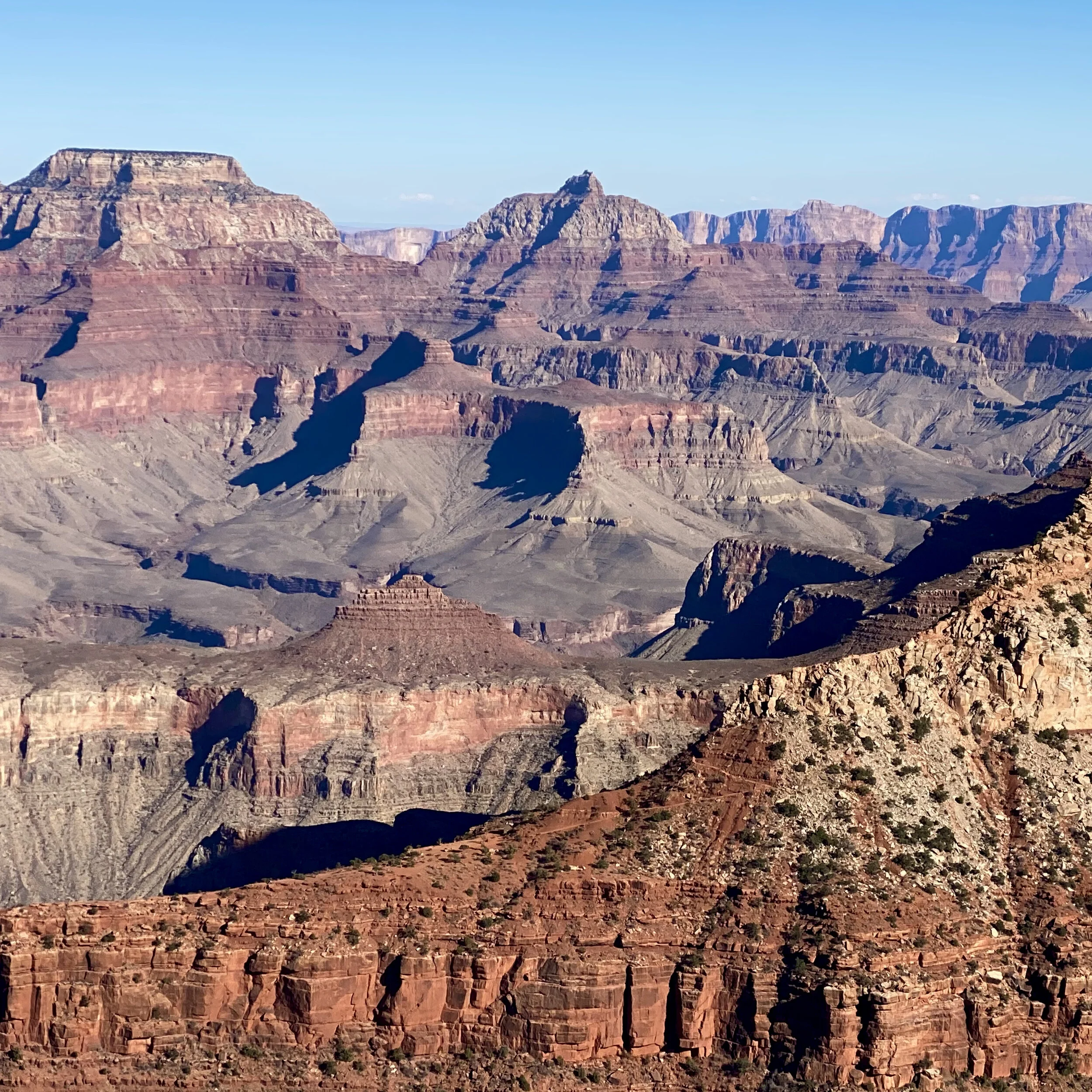
The Visitor Center is more or less the designated midpoint of the South Rim and its many viewpoints, with Mather point the first spot you’ll find.

Views from South Rim Mather Point Grand Canyon, Arizona
Part of the Canyon's magic, beyond its vastness, is the range of colors in the layers of sandstone and volcanic rock. Everything from vermillion reds, to rust colors, and even shades of white and gray. Take a look at both photos for a first glimpse of this magnificent landscape from Mather Point.
Arriving after lunch, I suggest you meander along the eastern route of the Rim trail from the South Rim Visitor Center. Head over to see Mather Point first, (right behind the Visitor Center) and then follow the Rim Trail to the South Kaibab Trailhead. This is a leisurely 1.5 - 2 hour walk with plenty of time for gazing and photos (2.4 miles).
Reverse your route and walk back or take the free 30 minute Kaibab Rim (orange) shuttle back to the Visitor Center. While walking back the light will be different and you’ll see the Canyon from a different angle, so it’s worth your time to do so if your legs can manage the extra miles!

Early Sunset from Mather Point
This afternoon is the perfect opportunity to catch your first sunset. While any overlook along the Rim is great for sunset (or sunrise) views, in my mind the perfect spot is at the mid-point of the Rim Trail, Mather Point, which you will have just returned to after this afternoon’s stroll.
What’s beautiful about this sunset experience is how colors along the Canyon walls become so much more vivid and the sky glows brilliant shades of orange. The tops of the Canyon walls turn a golden color, as if lit up by a spotlight.

Two minutes later, Sunset at Mather Point, Grand Canyon, Arizona
As the sun is setting, a unique blue line appears between the orange sky and the canyon walls. Just a couple of minutes later, blue sky reappears above, and the orange glow shrinks significantly. In an instant the light show is over and it’s dark.
It’s a very unique and peaceful experience. It was a clear day when I was there. Wish for clouds when you go for an even more stunning show.
Day 2: If you are fit (and crazy enough), consider hiking the Canyon to the Colorado River. You’ll likely start at the Kaibab Trailhead as it significantly shortens the distance vs. its sister trail to the west, Bright Angel.
From this trailhead it’s a 6.9 mile, 4700 foot descent to the Colorado River. The problem is really not so much descending but the fact that you have to return another 6.9 miles and 4700 feet of vertical to get back to the Rim. On average it takes at least twice as long to come up the trail as to go down. Experts say plan at least 11 hours for the roundtrip.
This kind of a hike is way too much cardio for me! But if you want to step foot on the trail, as most of us have, just walk as far as you like in to experience the Canyon surrounding you.
Alternatively, riding the mules into the Canyon is a great lower cardio way to experience the Canyon from within. Mule trips leave from the Kaibab trailhead area
You will have a sore butt after 8 hours on a mule. It isn’t for the faint of heart because the trail is quite narrow, and it feels like these animals wander precariously close to the edge. Fear not, these mules have done this trail countless times and know the way. Check out Mule Trip Options for more info. There are several options including shorter 2.5 hour rides, and departures from both Kaibab and Bright Angel Trailheads. This is another adventure that books up months in advance so plan ahead.
After your mule ride or day trip into the Canyon, check out Hopi Point for another stunning sunset. Hopi Point is a popular overlook on the west Rim, which you can walk or shuttle to depending on where you end up after day 2’s activities.
Day 3: Get an early start and take in a sunrise somewhere near Grand Canyon Village. Hopi Point where you saw the sunset last night is a great choice and it will give you a completely different feel than the sunset.
Post sunrise, from Grand Canyon Village take the Red Route park shuttle to Hermit’s Rest. This is a 45 minute shuttle ride one way with 9 scenic stops.
Pro Tip: stay on the bus. My advice is to take the shuttle all the way to the end at Hermit’s Rest and walk back to Grand Canyon Village along 8 miles of the Rim Trail where you will see some of the most stunning views of the Canyon. This will save you incredible amounts of hassle and frustration with Covid-related shuttle restrictions as the capacity per bus is severely limited (to 15 people).
If you get tired, you can hop on the return bus at four scenic locations and ride as far as you like including all the way back to the Village. March through November no private cars are allowed on Hermit Road so the shuttle is your only option. Be prepared to wait in line half an hour or 45 minutes for a return shuttle, longer the closer to the Village you try to board as the shuttles fill up first come first serve with weary travelers from the earlier viewpoints.

Hermit’s Rest at the far west end of the South Rim Grand Canyon, Arizona
After the shuttle ride, Hermit's Rest welcomes you at an arch with a broken bell that was acquired from a Spanish mission in New Mexico.
The building, a few yards beyond was built in 1914. Mary Colter was its chief architect. She designed it to look like a building made by untrained mountain men using timbers and stone native to the area. Its purpose was to serve as a rest stop for a stagecoach line that came through the area.
Today it’s a gift shop with restroom. Light refreshments can be purchased here as well. It’s truly the perfect place to start your day’s journey exploring the western half of the Rim trail.
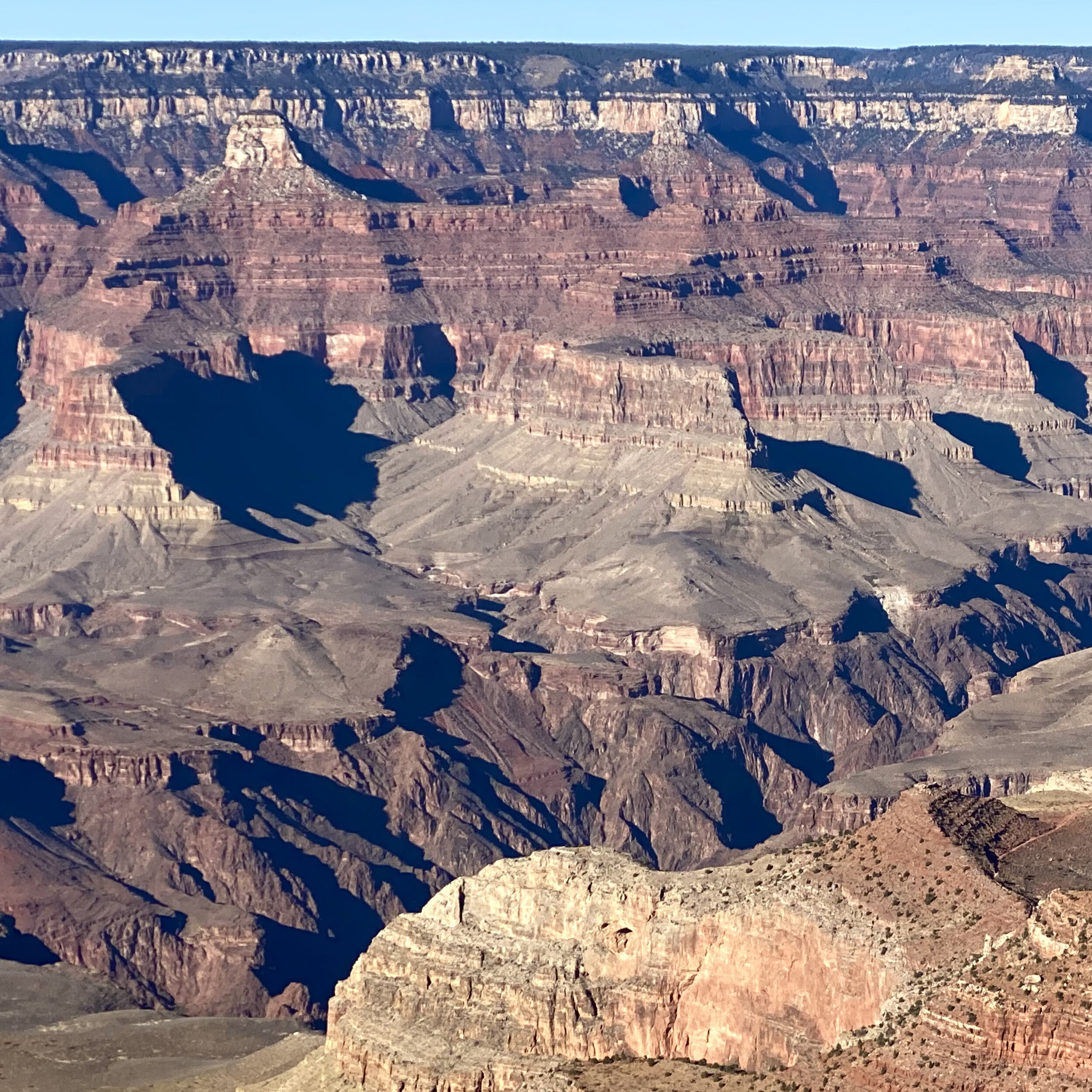
On your walk back to the Village along the rim trail, you’ll catch glimpses of the Colorado River where the whitewater rafting adventures from Lee’s Ferry unfold. For those preferring a strenuous hike from the Rim to see the Colorado River up close, instead of navigating the river with its category 4-7 (out of 10 maximum difficulty) rapids, you’ll see Bright Angel Trail meandering its way through this section of the park to the river.

Grand Canyon South Rim Views with a glimpse of the Colorado River
The Bright Angel trail is beautiful and well maintained but not for the faint of heart as it’s 4380 feet descending to the river and 4380 feet of vertical back to the top. Round trip this is 19 miles of all day hiking (5 miles longer than its sister trail the Kaibab that starts a bit further to the east).

West Rim with portion of the Bright Angel Trail and Colorado River
Leaving the park and heading back to the nearby town of Tusayan, stop and snap a photo with Smokey the Bear.
Since we’re in Covid-times, even Smokey is masked up for safety.

Take advantage of the photo opp with Smokey the Bear near the Grand Canyon’s South Rim Entrance
Smokey was a real, live bear caught in a New Mexico wildfire in 1950. He was just a cub, separated from his mother, wandering along the fire line.
Smokey climbed a tree which became heavily charred in the fire and as a result, he sustained burns to his paws. Smokey was rescued by firefighters and rehabilitated in nearby Santa Fe.
Our favorite Smokey Bear became the living symbol of wildfire prevention. The slogan associated with his name and image has endured for decades.
Only you can prevent wildfires.
Interestingly, this is the longest running public service advertising campaign in U.S. history.
Summary: This is full three day itinerary, three and a half if you stay overnight after exploring day 3 (which I recommend). I stayed in the town of Tusayan which is a 15 minute drive to the park. It’s much easier (and cheaper) to find accommodations on short notice here versus in the park. If you’re planning ahead, there are a few spots I’ve stayed in the park – El Tovar (nicer), Maswik Lodge, and Bright Angel Lodge (both more basic) - are all right at the south Rim and great options.
Be careful when using an app like Hotels.com or Expedia and typing in “Grand Canyon”. These apps don’t differentiate between North and South Rim which are only 15-30 miles apart as the crow flies but a couple of hours driving time. Almost all the hotels listed are on the South Rim, just call to confirm how close the hotel you choose is to the South Rim entrance to avoid surprises. Anything in Tusayan is a “go”.
I hope this helps you plan an enjoyable visit to the Grand Canyon. Most of the pictures (all are mine) have links to sites I found useful for planning or education. If you have any questions please feel free to reach out in the comment section below and I’ll share more of what I’ve learned. If you are interested in more photos or more stories, check out my Instagram @travelistaliz where I’ve just wrapped up a series of posts on this area.